Methane Detection
The airborne solution for fast and high-precision methane detection from a distance
How it works
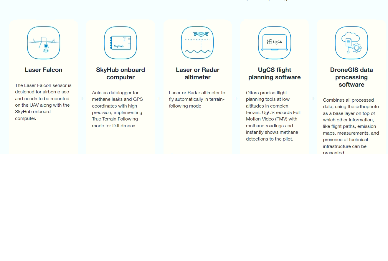
The Laser Falcon uses TDLAS-tunable diode laser absorption spectroscopy. The methane detector emits the laser beam and measures the reflected energy. When the laser hits a methane cloud, energy is absorbed, and the sensor registers the presence of methane.
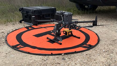
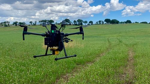
The Laser Falcon sensor is designed for airborne use and needs to be mounted on the UAV along with the SkyHub onboard computer. The SkyHub onboard computer records the sensor readings and GPS coordinates with high precision, making it possible to build accurate methane emission maps and develop precise work orders for field teams. Drones help significantly reduce the area for on-foot inspection and make it at least 3 times faster.
The system with Laser Falcon can be used for different types of inspection, like gas facilities, pipelines, and landfills
The main task for the Laser Falcon kit is screening; this tool can’t be used for methane quantification.
Screening is an activity of locating methane emission sources and ranging them by relative intensity for further analysis. Quantification determines an emission rate, such as mass or volume per time. This can be done directly through measurement of the emissions or indirectly through estimations, calculations, and modelling.
Deliverables
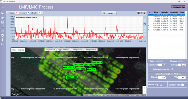
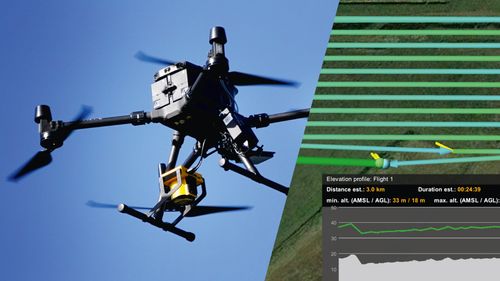
Fig.1 - Example of data collected using drone-mounted Laser Falcon methane detector over an artificial leak
Results of methane measurements using the Laser Falcon can be represented in multiple forms. The most popular are coloured heat map overlay, 3D map with methane spikes, or thermal map overlay in GIS software.
Processed data can be exported as a text document or PDF or shared through the link to the DroneGIS platform.
Recommended industry practices
Good screening method should conform to essential requirements:
- High speed of data collection
- Low dependence on the geometry and location of inspected equipment: landscape, vegetation, vertical structures
- Ability to collect data remotely to ensure the safety of personnel and reduce the chance of methane ignition
- Low false positive and false negative rates to minimize data verification effort
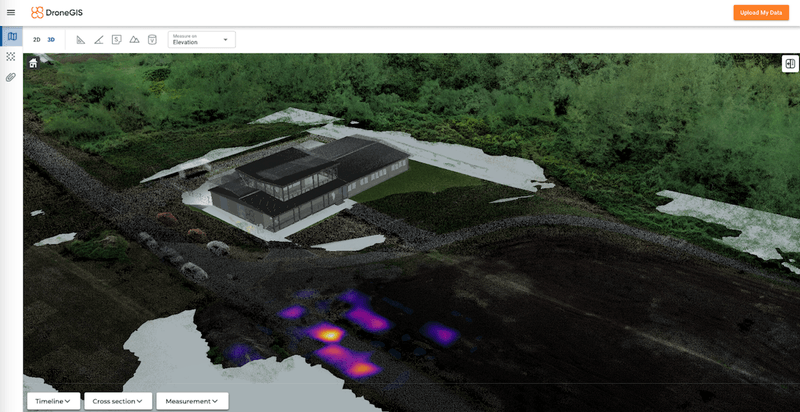
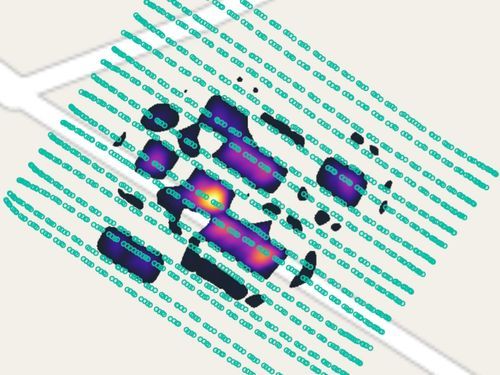
Fig.2 - Example #1 of data collected using drone-mounted Laser Falcon methane detector as an overlay on 3D map. Preview in DroneGIS »»»
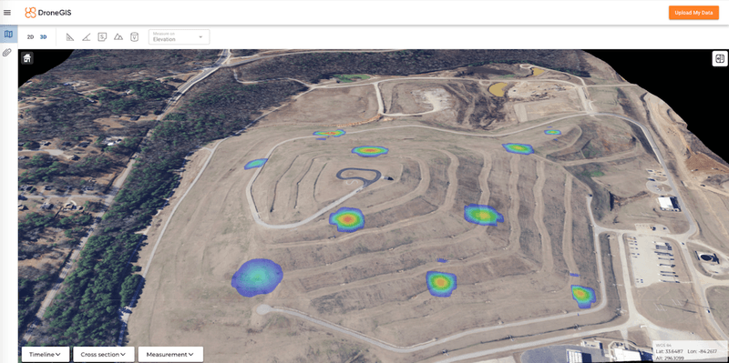
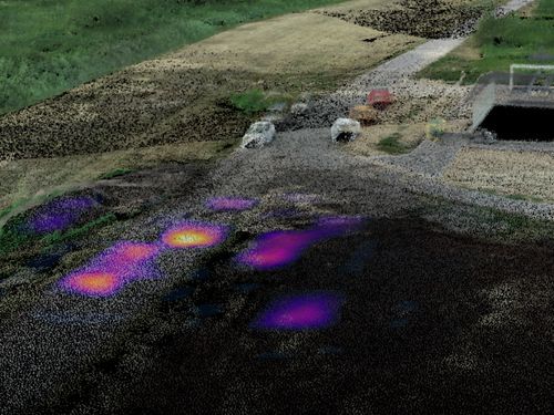
Fig.3 - Example #2 of data collected using drone-mounted Laser Falcon methane detector as an overlay on 3D map. Preview in DroneGIS »»»
Benefits of methane inspection with UAV
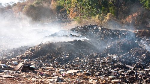
Traditional methane leak detection methods involve using a car, helicopter, or ground crew with handheld devices. Sometimes, the use of these methods can be complicated, especially in the case of small, hazardous, or hard-to-reach areas. Using helicopters for surveying small areas is not economically feasible, and roads are needed for cars equipped with methane detection sensors. Ground inspections take a lot of time and are not always safe for humans due to hazardous areas. Installing stationary detectors at landfills is difficult because the active area of the landfill constantly changes the terrain.
-
The better approach is to fly a drone (UAV) to carry the methane sensor.
A drone is compact and easy to transport and deploy. It is also highly precise in following planned survey lines and can be used anywhere there is at least a small area for take-off and landing near the surveyed area.
Consider mapping methane leaks on a landfill using, for example, a DJI M350. Given its battery endurance, speed of 3-7 m/s (recommended to Falcon sensor), line spacing of 5-15 meters, and elevation variations, it can cover roughly 2.5-5 hectares per battery set. That means the UAV can survey 5 hectares in just one hour, which is over 6 times faster than ground crews and 2 times faster than sniffer drones.
-

Works in a hazardous environment
With UAV, you can thoroughly survey landfills, a gas pipeline section, or other gas infrastructure facilities where access from the ground is impossible or restricted. The system works in a hazardous environment that humans cannot approach freely. A drone with Laser Falcon can detect methane molecules with high confidence at a distance of up to 30m.

Precise positioning
The drone's precise positioning while following the survey routes and ability to fly at a constant speed and specified altitudes result in high-accuracy and repeatable measurements.
-

Cost-efficient
For small survey areas, the mobilization cost for the helicopter or car with methane detection equipment may exceed the survey's price. A highly portable UAV system saves time for mobilization and deployment and will be more cost-efficient than a standard approach.
Typical applications
UAV-borne methane detection system allows fast remote scanning for leak detection and location. Discover the typical applications for drone-borne methane detection systems
-
Landfills inspection
-
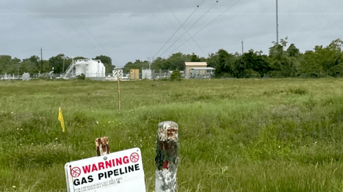
Gas pipeline inspection
-
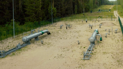
Gas facilities inspection (gas tank, pressure station, etc.)
Case Studies
-
Methane Leak Detection with a Drone: Proof of Concept
-
Drone Technology enables three times faster Methane Emissions Monitoring in Landfills
-
Identifying Landfill Hotspots and Methane Emissions with Drones
-
Laser Falcon sensor used to detect methane leaks in the landfills in the Netherlands
-
Test & evaluation of the Falcon Methane sensor to assess the effectiveness of UAV emissions detection
Data Sets
The methane detection system records data in two standard formats
Discover the downloadable data-sets of drone based methane detection surveys by SPH Engineering »»»
- Falcon 2 Methane data
- Methane data combined with Point Cloud
Frequently Asked Questions
| Line spacing / Speed | 4 m/s | 5 m/s | 6 m/s | 7 m/s |
| 2m | 2.3 | 2.9 | 3.5 | 4 |
| 4m | 4.6 | 5.8 | 6.9 | 8.1 |
| 6m | 6.9 | 8.6 | 10.4 | 12.1 |
| 8m | 9.2 | 11.5 | 13.8 | 16.1 |
| Flight type/ Speed | 4 m/s | 5 m/s | 6 m/s | 7 m/s |
| One-way | 11.5 | 14.5 | 17.5 | 20 |
| One-way | 6 | 7.5 | 8.6 | 10.1 |