")
")
")
")
")
")
")
")
")
")
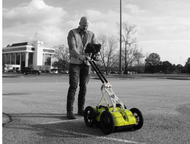
Impulse Radar (GPR Ground Penetrating Radar).
Detecting both metal and non-metallic pipes.
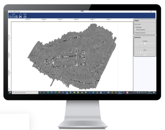
Ground Penetrating Radar (GPR) is a non-destructive technique of near-surface investigations.
ImpulseRadar is focused on bringing the latest technology to market, packaged in robust and user-friendly ways. As industry professionals, our staff have been influential in bringing to market innovative GPR solutions that have often driven paradigm shifts in the application of this effective non-destructive technology.
ImpulseRadar is Triple-A (AAA) rated by Dun & Bradstreet, in recognition of our high creditworthiness and capacity for meeting payment liabilities.
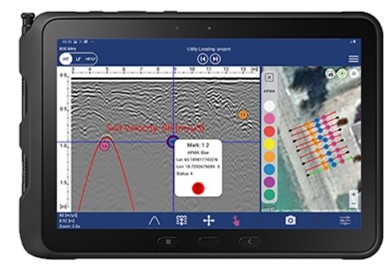
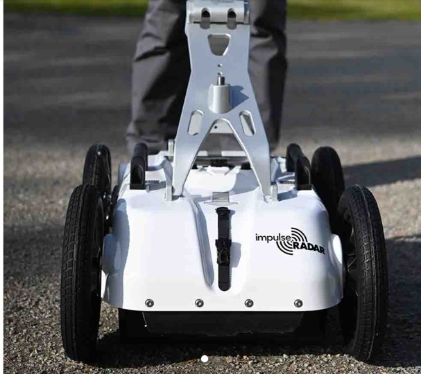
PinPointR Ground Penetrating Radar Utility Locator
The PinPointR has been developed to maximize in-field productivity by utilizing ImpulseRadar’s innovative real-time sampling (RTS) dual-channel antenna technology, which provides incredible bandwidth, speed, and resolution, all controlled via an intuitive Android-driven user interface.
The ImpulseRadar PinPointR offers a clear and dependable way to quickly and easily locate, avoid or map underground utilities with the functionality required to meet approved industry standards, whilst offering market-leading performance and data quality.
CrossOver Series
Series of Ground Penetrating Radar systems CrossOver is a general-purpose series of GPR-systems, in three different housings and with 6 separate frequencies in the range 70- to 800MHz. It is designed for the professional-geo community. It may be pulled or pushed in dedicated carts, by hand or by means of vehicles, at any speeds.
Each system comes as a true-dual frequency antenna with inbuilt control electronics and GPS-modules. The systems are controlled via Android-pads over a wireless link. It is based on real-time-technology which gives excellent depth penetration and bandwidth. Low power consumption gives 7 hours operational time, on one battery.
Raptor
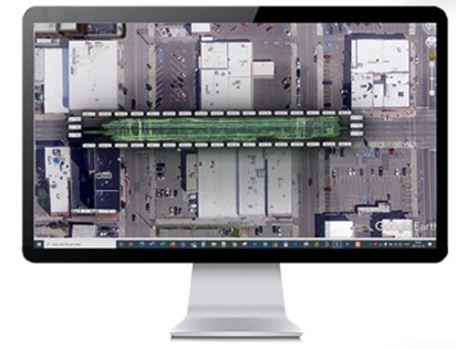
High Speed 3D Ground Penetrating Radar Array
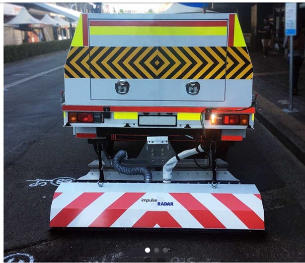
Raptor is a multichannel high-speed 3D-GPR Array (MCGPR) enabling the very fast collection of 3D GPR data, at speeds in excess of 130 km/hr (80 miles/hour), @ 5 cm point intervals. Raptor is capable of survey speeds that eliminate the need for traffic control and safety vehicles. Conventional systems typically operate at no more than 30 km/hr, with similar settings.
- Archaeology
- Ice/Snow investigations
- Infrastructure investigations
- Law enforcement and military
- Road/Bridge inspections
PLT 600
Discover the best hand-held and multi-purpose compact GPR system
Excellent performance for shallow investigations